")
support@meisterdrucke.com · 0043 4257 29415


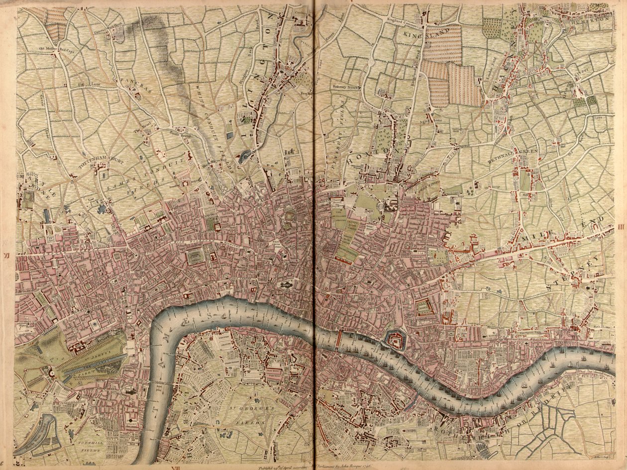
'Een exacte kaart van de steden Londen en Westminster, de wijk Southwark, met het land tot tien mijl rond', ca. 1746 (gravure)('An exact survey of the cities of London and Westminster, the borough of Southwark, with the country near ten miles round', c.1746 (engraving))John Rocque |
|
€ 142.61
Enthält 21% MwSt.
|
|
Niet gedateerd · engraving
· Afbeelding ID: 1504893
National Maritime Museum, London, UK / Bridgeman Images |
|
|


.jpg "Een kaart van Old London Bridge, Londen, 1746")
.jpg "Een kaart van Bloomsbury en Holborn, Londen, 1746")
.jpg "Een kaart van Wapping, Londen, 1746")
.jpg "Een kaart van het Koninklijk Paleis en de tuinen van Kensington, Londen, 1736")
.jpg "Een kaart van Clerkenwell, City of London, 1746")
.jpg "Een kaart van Shoreditch en Whitechapel, Londen, 1746")
.jpg "Een Kaart van Limehouse en Rotherhithe, Londen, 1746")
.jpg "Een kaart van Covent Garden en Westminster, Londen, 1746")
.jpg "Een kaart van het West End en Soho, Londen, 1746")
.jpg "Een kaart van Mile End en Stepney Green, Londen, 1746")
.jpg "Kaart van Battersea & Chelsea, 1748")
.jpg "Een kaart van Marylebone, Londen, 1746")
.jpg "Een kaart van Moorfields en Hoxton, Londen, 1746")
.jpg "Een kaart van St Pauls en Bankside, Londen, 1746")
.jpg "Een Kaart van de King")
.jpg "De Zondvloed")
.jpg "Ontbijt van de roeiers")
.jpg "De kruisiging, van het Isenheim Altaarstuk, c.1512-15")
.jpg "Uitzicht op een haven")
.jpg "Vissers op zee")
.jpg "Een van de familie")
.jpg "De val van de verdoemden")
.jpg "Tuin in St. Germain, de Europese wijk nabij Tunis")
.jpg "Vrouwen van Tahiti, Op het Strand, 1891")
.jpg "Zon schittert over de zee, Skagen")
.jpg "Enkele Nieuwjaarsgebruiken in Galloway")
.jpg "Waterlelies")
.jpg "Uitzicht op de Naruto-wervelingen bij Awa, uit de serie")
.jpg "Schubert aan de piano")